- Select a language for the TTS:
- UK English Female
- UK English Male
- US English Female
- US English Male
- Australian Female
- Australian Male
- Language selected: (auto detect) - EN
Play all audios:
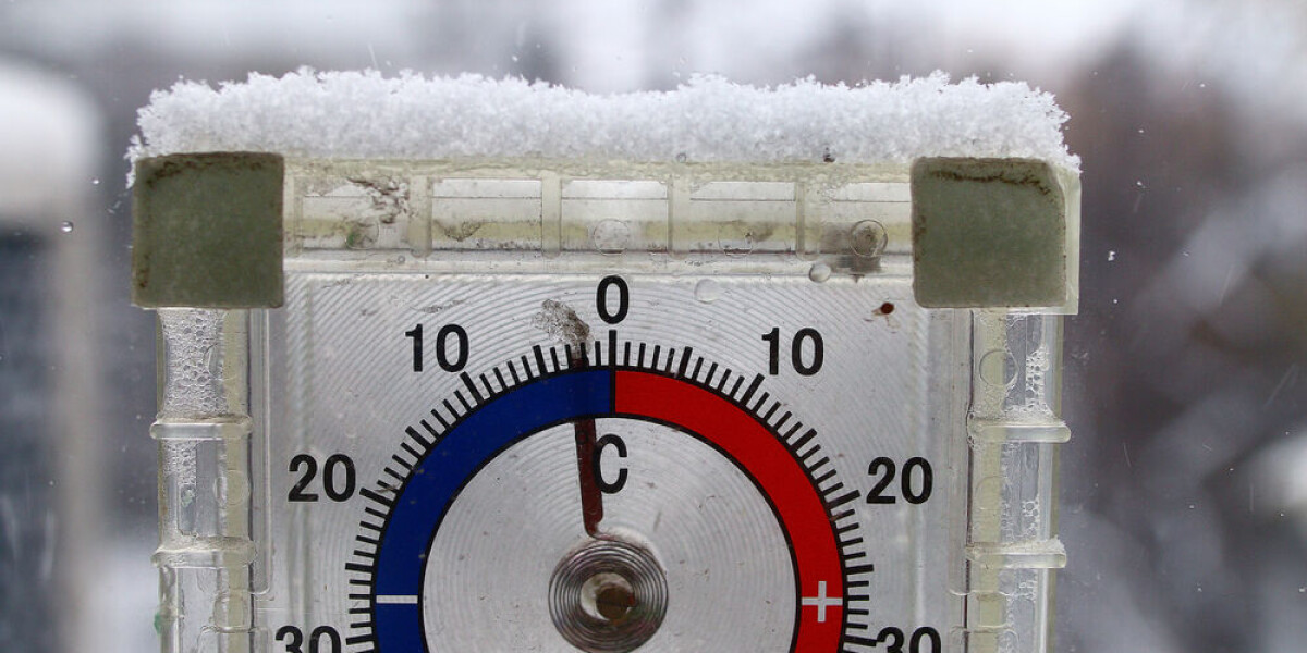
ONE DEPARTMENT STILL REMAINS ON HEIGHTENED ALERT FOR FLOODING A mild weekend is forecast in France but is set to be followed by a drop in temperatures to between 5C – 10C - 5C colder than
usual for this time of year - as a polar wind sweeps in. Below-zero morning temperatures are expected in the west, centre and east and particularly in the Alpine and Massif Central areas.
Icy conditions will be present in many areas although not close to the sea (especially the Mediterranean coastline). The cold snap is predicted to last until the following weekend. It comes
as heightened warnings remain in place in the north and east of France for river flooding due to heavy rainfall. A tier-three orange warning remains in Charente-Maritime, which has been on
alert for almost all of the week. Elsewhere, 30 other departments in mainland France are facing lower tier-two yellow level alerts for river flooding. RIVER FLOODING WARNINGS PERSIST Despite
not causing extreme damage like its COUNTERPARTS STORMS CIARAN OR DOMINGOS, Storm Frederico caused showers and strong winds across almost all of France yesterday. The rain has stopped in
most locations (save for around Limoges and in the east), however the long-lasting effect was another rise in river levels, many of which are already high after a record-breaking amount of
rainfall in recent weeks. Subsequently, around half of mainland departments are facing high river level alerts, particularly in the centre-west and north-east. You can find out more
information about which river levels in your area are high using the Vigicrues WEBSITE. Winds of up to 170 km/h could be recorded in coastal areas of north Corsica this morning, although
_Météo France_ says the gales will “quickly die down” by midday. However, they could still reach 130 km/h until late in the afternoon. You can keep up to date with weather alerts using the
official _Météo France_WEBSITE. PAS-DE-CALAIS FEARFUL FOR WEEKEND RAINS The two northern departments facing heightened weather alerts (Nord and Pas-de-Calais) have suffered greatly, and any
rainfall over the next week is likely to see them return to a state of alert, as rivers remain at high levels and fields waterlogged. Some schools in the area remain closed, and the SNCF
announced the train line between Boulougne-sur-Mer and Étaples would be affected for ‘several months’ due to damage. Nearly 600 homes in the area remain without electricity, and thousands
have been badly damaged by floods. Currently, _Météo France_ is predicting that no departments will face any weather warnings on Saturday (November 18). However, many times in the past two
weeks warning levels have been updated overnight, as rain has hit areas – such as Pas-de-Calais – where rivers are already at their limit. More rain is predicted over the weekend in the
north, and whilst rainfall will be closer to showers than torrential downpours, any rain in the area will contribute to further flooding until soils have soaked up the current above-ground
excess – a process which could take weeks. Meteorologist Patrick Marlière said that “three months of rainfall has fallen [in the department] in only 15 days,” and it will take weeks of dry
weather for the situation to return to normal. READ MORE: OVER 240 COMMUNES IN NORTH FRANCE PLACED ON NATURAL DISASTER LIST RELATED ARTICLES WHAT TO DO (AND NOT DO) DURING HEAVY RAIN AND
FLOOD ALERTS IN FRANCE SEA BIRDS BLOWN OFF COURSE AND INTO SOUTH WEST FRANCE BY STORM